Position Display
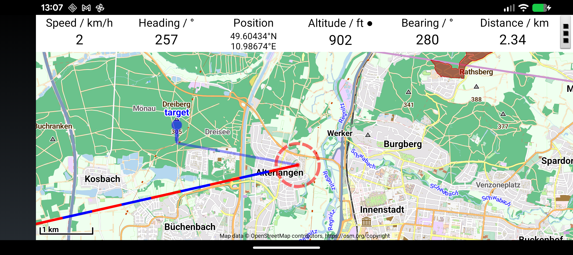
The status bar at the top of the map displays your current position, altitude, speed, and other flight data.
Position Formats
Your position can be displayed in several formats, configured in Settings → Display → Position Units:
| Format | Example | Use case |
|---|---|---|
| Degrees (decimal) | 51.47500° N, 0.94556° W | General use |
| Degrees-Minutes-Seconds | 51° 28' 30" N, 0° 56' 44" W | Traditional aviation |
| UTM | 31U 604123 5704567 | Competition / grid navigation |
| British National Grid | TQ 123 456 | UK-specific |
Tip
Quick toggle: Tap the position field on screen to temporarily switch to Degrees-Minutes-Seconds format, regardless of your setting. Tap again to switch back. Useful when navigating in UTM but needing to read out a lat/lon.
Altitude Display
Altitude is displayed from GPS. The unit (feet or metres) is configured in Settings → Display → Height Unit.
For pressure-based altitude using the device barometer, see Barometric Altitude.
Speed & Bearing
- Speed is shown in units derived from your distance setting (km/h, mph, or knots)
- Bearing shows your current direction of travel
Customising the Status Bar
The status bar fields are customisable. Long-press any field to change what it shows. Available options include:
- Position
- Altitude (GPS or barometric)
- Speed
- Bearing / heading
- Distance to reference point
- Time to waypoint
- Flight time
- Current time
In landscape orientation, additional fields appear showing bearing, distance, and estimated time to the active waypoint.
Distance Display Toggle
Tap the distance field to toggle between distance to waypoint and time to waypoint (estimated arrival based on current speed).